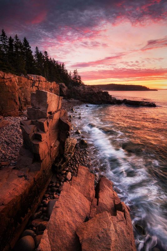
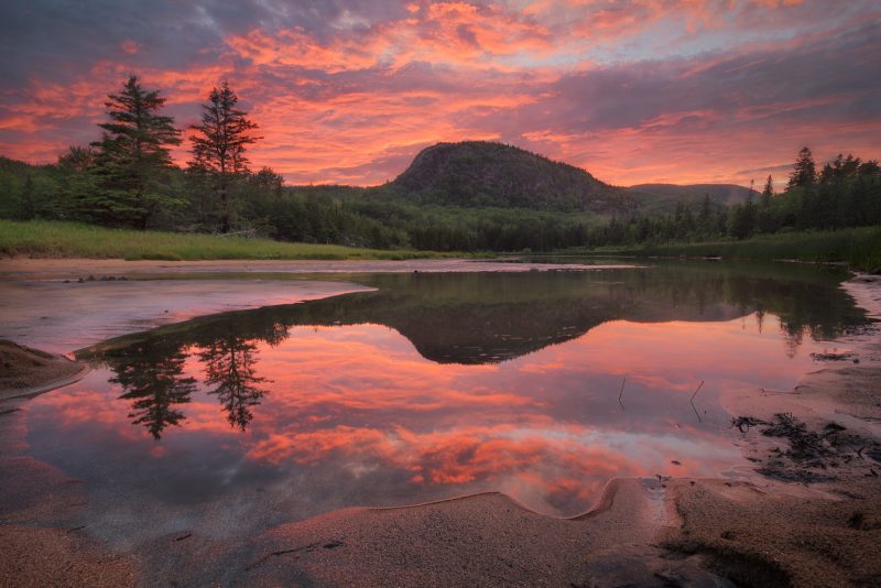
The Best Smartphone Apps for Landscape Photographers

As landscape photographers, we have a wide range of tools contained in our smartphones to aid in the quest for the perfect image. From basic weather apps to feature-packed planning apps with augmented reality features, we can be ready to take that perfect image when we head out into field. The sheer number of apps available can be a little intimidating, but these are the best smartphone apps for landscape photographers that I believe will give you all the tools you need to prepare for your next outing.
This article will cover apps that are available for both Android and iOS. There are other useful apps that are available only on one operating system, but those will not be covered here. Additionally, because the descriptions and screenshots are based on the Android versions of the apps with dark mode activated, there may be occasional slight differences with the appearances and features of the iOs versions. All app prices are from the time of writing (April 2020) and are in U.S. dollars.

Apps for weather forecasts
Weather is the most important factor affecting your final image, so that’s where we’ll begin our journey. Most basic weather apps are good for getting a general idea of the forecast, but don’t have the ability to display future conditions in a way that’s helpful to landscape photographers.
The more advanced apps can do this and much more. They offer a lot of powerful tools to help increase your chances of being in the field during the best conditions, rather than watching them happen outside your window.
Weather Underground (Free/$19.99 per year or $3.99 per month)
Even though most popular weather apps (The Weather Channel, Accuweather, etc) have similar features and functionalities, my favourite one to use is Weather Underground.
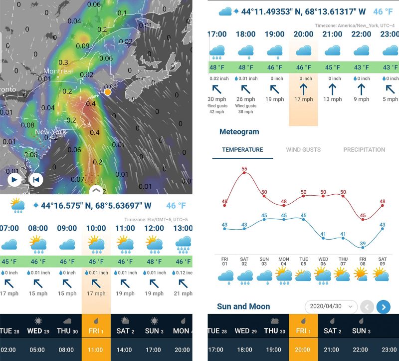
Weather Underground is a good basic weather app with a 10 day forecast in the free version (or 15 days in the premium version). The app offers an overview of the current conditions, a radar map with different layers that can be toggled on or off, and a daily and hourly forecast with a very helpful graph detailing the conditions. There is also a section with sun and moon rise and set times.
The web version has a few additional layers on the graph that can be toggled and are helpful for quickly seeing cloud cover.

Windy (free/$2.99 per month)
Windy is a very feature-rich app, especially for a free app, and has almost every bit of weather-related information you could hope for all in one place.
The main display is an interactive map with a pop-up forecast graph that can be scrolled side-to-side to change the date and time displayed on the map. The free version shows the information in three-hour time blocks, while the paid version displays in one hour increments. The map also features particle animations for wind direction, wind speed, and wave direction, which can be helpful for determining where to photograph big surf.

Windy offers 43 overlay options to choose from, plus weather radar and satellite. Cloud cover (which can be further divided into high, medium, low, and fog), wind direction, precipitation, wave height and direction, and tide height are some of the more useful overlays for landscape photography.
There is also a satellite view option for checking the actual cloud conditions before venturing out with your camera. Windy also has a website set up the same way as the app, which comes in handy for those who do some of their planning on the computer as well.

VentuSky (Android: free/$2.99 per year, iOS: $2.99)
VentuSky is very similar to Windy, with a few differences. It doesn’t offer as many overlay options as Windy, but offers sun and moon times and historical data that photographers planning a trip to a new area can use to get an idea of the conditions at any time of the year.
The biggest difference is that whereas Windy is fully functional in the free version, VentuSky reserves most of its overlays (including cloud cover, wind, and waves) for the premium version of the app.
Apps for predicting the tides
The position of the tide is one of the more important factors affecting seascape photography, so it really pays to know what the tide will be like when you’re heading out with your camera. Even though tide charts are readily available online, nothing beats the simplicity of opening an app and having tide information for your favorite locations ready to go.
Tides Near Me (free)
Tides Near Me is a simple app that shows the high and low tide times, tide heights, as well as the sun and moon rise/set times.
Once you select your area, there are three tabs which tell you the most recent and upcoming tide, a seven day tide forecast, and a map where you can view available tide stations and select the station you receive data from. You can favourite different locations to make it easier to switch between locations.
If all you need is to know when and how high a tide within the next week will be, this is a great no-frills app.

Nautide (free/$13.99 per year)
While Tides Near Me is simple and to the point, Nautide is an information-packed app for everything marine.
In addition to high and low tides, Nautide displays information about waves, sun, moon, and even weather conditions. The app displays all of this in useful graphs and tables, and contains more than enough information for any seascape photographer.
The free version only offers single day forecasts, but yearly data packs (purchased by the calendar year) give you access to tide charts for the full year, 7 day forecasts for surf and sea conditions, and 14 day forecasts for weather. All of this information is also available for free online at tides4fishing.com, including 7 day forecasts for weather and sea conditions.

Apps for astrophotography and night sky photos
Astrophotography, both in its landscape and deep space forms, has slightly different requirements for planning and forecasting than diurnal landscape photography. Both generally require clear skies, but while landscape astrophotographers can get away with some thin high-level clouds or some light pollution in their image, deep space astrophotographers require the darkest, clearest skies possible.
Specialised astrophotography apps collect all of this information in one place, and are very useful for landscape astrophotographers when planning Milky Way images. Planetarium apps help astrophotographers find targets other than the core of the Milky Way in the night sky, as well as provide something fun to do while waiting for the core to move into position.
Read more: The Ultimate Guide to Astrophotography

Astrospheric (free, US and Canada only)
Astrospheric is a simple but very useful app for determining the clarity of the night sky.
The most useful part for landscape astrophotography is the percent cloud cover, but it will also display the transparency and seeing of your chosen location. This essentially tells you how much fine detail is visible through the atmosphere, displayed in a clean graph underneath a map with a cloud cover overlay. Astrospheric offers a 48 hour forecast in one hour intervals, as well as an extended 10 day cloud forecast in 3 hour intervals.
Astrospheric also displays the Kp index for aurora chasing, moon phase and rise/set times, and International Space Station flyover times, as well as basic weather information like wind speed and direction, temperature, and dew point.

Light Pollution Map (free/$9.99 per year)
Light Pollution Map is a great tool for finding dark sky sites for astrophotography, as well as ensuring that you don’t get to a location and discover that your intended target is washed out by a dome of light pollution from a nearby city.
The app opens to a map with a colour-coded overlay that represents the amount of light pollution in the area. The free version has a number of included tools (such as an aurora visibility map, night event calendar, and moon phase info), while the paid version offers cloud cover and live aurora visibility overlays.

SkySafari ($2.99/$14.99/$39.99)
SkySafari is a powerful planetarium app that helps you find and identify constellations, deep space objects, and satellites.
It also displays interesting information, history, and images of the objects. You can also see when specific objects rise above the horizon and track their location in the sky over a given time.

Stellarium Mobile (Android: $3.49/Plus: $9.99. iOs: $2.99/Plus $9.99)
Stellarium Mobile is another excellent planetarium app similar to SkySafari. The sky view is a little more realistic, but the menu system isn’t quite as intuitive.
You can also zoom in to deep space objects to see actual images of them overlaid onto the background to get an idea of their relative size in the sky.

SpaceWeatherLive (free)
SpaceWeatherLive is an excellent app for aurora alerts and space weather information. It has numerous graphs and tables that display a wide variety of measurements related to auroral and solar activity.
There is also a handy map with a real-time overlay of the aurora visibility oval. You can set the app to provide alerts when there is elevated auroral activity, a solar flare, or other notable space weather event.

Apps for planning your photography
These apps are likely the most powerful tools for landscape photographers. They offer a huge number of features that allow photographers to set up and plan their images.
You can mark compositions, see where the sun and moon will rise and set, and even use an augmented reality viewer to see where the Milky Way will be at a given time of night. They take longer to learn how to use, but have so many helpful features that it’s worth the time and effort.
PhotoPills ($9.99)
PhotoPills is crammed full of useful information for planning your photography outings. It has a planner section where you can view a map with lines that show you where the sun, moon, and Milky Way rise, as well as where you can access the AR (Augmented Reality) and Night AR functions. You can also save and load plans and points of interest, which helps when scouting locations or returning to compositions you have previously scouted.

PhotoPills also contains a number of calculators and tables. There are calculators for exposure values with ND filters, depth of field and hyperfocal distance, field of view for practically any camera and lens combination, shooting intervals for time lapse, and more. It also provides times of significant photography events for any given date, such as the beginning and end of golden hour, blue hour, nautical twilight, and astronomical twilight, in addition to the rise and set times for the moon, sun, and core of the Milky Way.
Because there are so many features, PhotoPills has included tutorials, how-to articles, and a user guide in the “Academy” section of the app which are helpful for discovering some of the more advanced features.
PlanIt Pro ($9.99)
PlanIt Pro offers even more features than PhotoPills in a similar looking app. PlanIt Pro’s main screen is a map with different modules that can be activated by swiping the top banner to either side.
Like PhotoPills, PlanIt Pro includes modules with rise and set times for the sun, moon, and core of the Milky Way, but also includes such features as star trails, rainbow position, cloud distance, and tides.

The location marking option is a little more sleek and informational than PhotoPills’s. When marking a spot, you can mark it with an icon that represents the scene or subject, with options including mountain, waterfall, interesting insects, or bird in flight location. You also have the option of rating different aspects of the location, such as the scenic value, photographic interest, road and trail difficulty, protection status, and if a permit is required to visit. 
The Photographer’s Ephemeris (Android: $2.99, iOS: $9.99 or $19.99 for three app bundle)
The Photographer’s Ephemeris is the only app on this list where the Android version is dramatically different from the iOS version. The Android version (shown below) is a basic map with lines marking the position of the sun and moon at any time of the day and the direction in which they rise and set. You can drop and save pins, but that’s about the extent of what you can do.
The iOS version, in combination with its companion apps The Photographer’s Ephemeris 3D and The Photographer’s Transit, offers night sky planning, an augmented reality view for scouting, 3D visualisations of where light will fall on the landscape at a given time, and field of view visualisation tools.

Google Earth (free)
Even though it doesn’t offer photography specific features like the above apps, Google Earth is still a great resource for virtual location scouting and getting a quick 3D view of an area you haven’t been to before.
It also has a handy distance measuring tool to see how far away certain features are. The desktop version is much more powerful, and has more tools and display options that can help you plan your compositions from home.

In conclusion
With so many apps available to photographers, it can be hard to choose the best ones to help plan your landscape photography outings. Each app has its own speciality, and I believe that this combination of apps covers everything from scouting and marking locations to figuring out when the best conditions will happen.
Whether you’re just looking for a new weather app, or a fully tricked out image planning app with tons of bells and whistles, I hope this article was useful in your quest to make the best images possible.